| Nilagiri State | |||||||
|---|---|---|---|---|---|---|---|
| Vassal state of Maratha Confederacy (1751 - 1803) Princely State of British India | |||||||
| 1521–1948 | |||||||
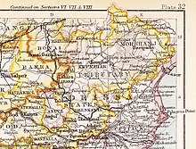
 Nilagiri State in the Imperial Gazetteer of India | |||||||
| Capital | Nilagiri | ||||||
| Area | |||||||
• 1931 | 723 km2 (279 sq mi) | ||||||
| History | |||||||
• Established | 1521 | ||||||
| 1948 | |||||||
| |||||||

Nilagiri State was one of the princely states of India during the British Raj. It belonged to the Orissa States Agency and its capital was at Raj Nilgiri,[1] which later became the modern town of Nilagiri.[2][3]
The state was bounded in the north and west by the State of Mayurbhanj and in the south by Balasore District. As of 1940, Nilgiri State had a population of 73,109 and an area of 263 square miles (680 km2). In 1949 it was merged into Balasore District.[4]
- ^ Columbia-Lippincott Gazetteer, p. 1325
- ^ India (State), Nilgiri (1968). Final Report on the Nilgiri Settlement: Commenced on 1st December, 1917 and Concluded on the 31st March, 1922. Printed at Sarada Press.
- ^ Pati, Biswamoy, 'Alternative Visions: Communists and the State People’s Movement, Nilgiri 1937–48', Tribals and Dalits in Orissa: Towards a Social History of Exclusion, c. 1800-1950 (Delhi, 2018; online edn, Oxford Academic, 21 Jan. 2021), doi:10.1093/oso/9780199489404.003.0006, accessed 18 Nov. 2023.
- ^ Amalgamation of Princely States
